|
Map of Rivers in America
Below is a map of rivers in America that are discussed on this website. We will continue to add more rivers. There are two ways to use this map. (1) Click on one of the blue pins and it will tell you what river that is. (2) If you click just below the map on "rivers" it will bring you up a listing of rivers and a larger map. Find your river in the alphabetical listing on the left and click on that river. It will take you right to the river.
You can get directions from any of these rivers from whatever starting point you input. Great for planning fishing trips to multiple waters. I hope this helps. Please contact us if you would like to add other rivers to this map, or have some great information to share.
I like to use this to find out how long it will take to get to a river. So if I put I pick the Yellowstone River and put in my address, I see it will take me just over 8 hours to get there. Now I can plan my trip! Give it a try.

|
Support our Website
View one of these related sites.

Sign up for Fish On News Letter
Receive regular newsletters about fly-fishing. Featuring great specials from our affiliate sponsors, new fish photos, tactics, product reviews and other fly-fishing articles. Fill out the form below to subscribe. Fish On!
Most Searched States
Montana
Colorado
Alaska
Oregon
Washington
North Carolina
California
Florida
Idaho
Utah
Stock Assault
Revolutionary Stock Trading Software proven to generate profitable winning trades on Autopilot in only one hour a day. State-of-the-art Artificial Intelligence. Click Here!
ROULETTE SYSTEM
Very best manual showing how to profit from online or real Casino’s Click Here!
Attract & Seduce Women
Learn how to meet, attract and seduce women -- from a woman. Best selling attraction and seduction guide for over 8 years. Click Here!
Trading Pro System
Make money regardless of whether the market goes up or down. Better that forex, penny stocks, day trading and swing trading. Over 24 hours of video. Click Here!
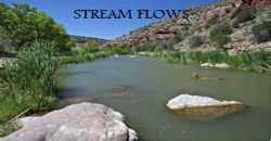
Click below for stream flow data
This is nationwide data, select your state, click real time data, then choose location. Having stable water conditions makes for better fishing.


